
### FireSat: Pioneering Wildfire Detection from Orbit
With the increasing occurrence and severity of wildfires driven by climate change, the necessity for swift detection and action has reached a critical level. Recent advancements in space technology are providing innovative solutions to tackle this escalating issue. While satellites have been utilized for monitoring wildfires, a groundbreaking project, **FireSat**, seeks to transform the methods of detecting and tracking these catastrophic events. Overseen by the nonprofit entity **Earth Fire Alliance (EFA)** and backed by significant philanthropic contributors, FireSat is preparing to launch a fleet of small satellites uniquely engineered for real-time wildfire detection.
### The Escalating Demand for Enhanced Wildfire Detection
While wildfires are a natural occurrence in many ecosystems, their prevalence and severity have surged in recent years, fueled by rising global temperatures and extended periods of drought. In 2021, for instance, the **Windy Fire** devastated regions of California’s Sequoia National Forest, endangering ancient sequoia groves. Such incidents underscore the pressing requirement for more timely and precise wildfire detection systems.
Historically, satellites have been deployed to track wildfires, yet these systems frequently lack the necessary sensitivity and speed to identify smaller blazes before they escalate. Enter FireSat, a cutting-edge project designed to recognize wildfires as small as a classroom anywhere on the planet.
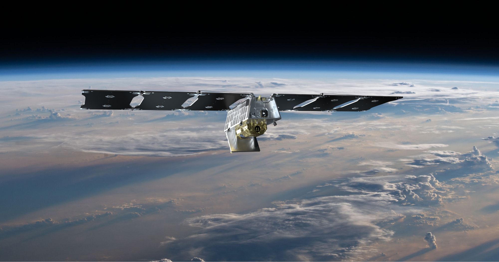
### FireSat: A Revolutionary Approach to Fire Detection
FireSat will be a constellation comprising over 50 small satellites launched into **low-Earth orbit**. In contrast to conventional Earth-observing satellites, FireSat will be the inaugural fleet committed exclusively to the detection and monitoring of wildfires. The initiative has received partial funding from **Google’s philanthropic division**, which recently declared a new investment of **$13 million** to aid the endeavor. This financial support will facilitate adherence to the timeline for the inaugural launch of the FireSat pathfinder satellite, anticipated next year, with the complete constellation potentially operational by 2026.
The **Earth Fire Alliance** states that FireSat marks a considerable advancement in wildfire management. “As fires intensify and propagate more swiftly, we believe that collaborative efforts are essential for fostering necessary innovations in fire management and tackling climate change,” the organization articulated in a statement.
### State-of-the-Art Technology for Immediate Detection
The satellites for FireSat will be crafted by **Muon Space**, a California-based startup specializing in satellite development. Each satellite will be outfitted with **six-band multispectral infrared instruments**, capable of surveying an area of the Earth up to **900 miles (1,500 kilometers)** wide. These sophisticated sensors will possess the sensitivity to identify wildfires as small as **16 by 16 feet (5 by 5 meters)**, marking a significant leap from existing systems.
What distinguishes FireSat is its integration of **Google AI** for the swift analysis of satellite imagery to pinpoint potential wildfires. The AI will juxtapose new data with earlier images to catch flare-ups while also considering local weather conditions and surrounding infrastructure. This enables emergency responders to obtain immediate notifications regarding the location and magnitude of a fire, facilitating more rapid and effective actions.